
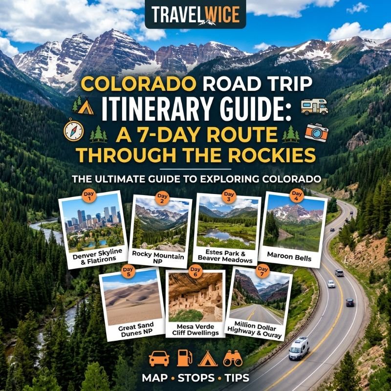
Colorado Road Trip Itinerary Guide: A 7-Day Route Through the Rockies
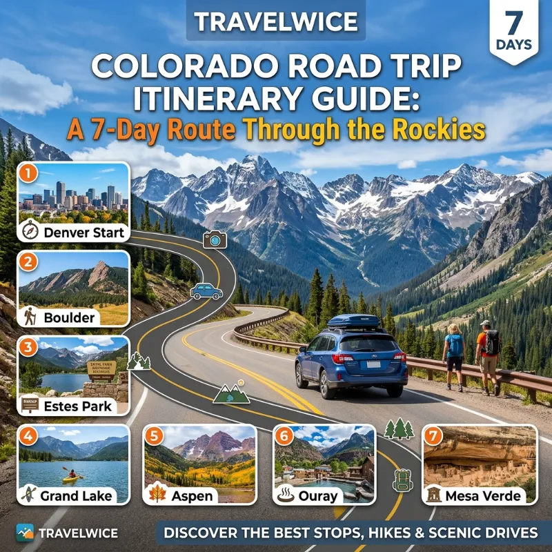
The road to Independence Pass climbs past 12,000 feet, and the first time you see the Continental Divide from your car window, you will forget about your phone. This Colorado road trip itinerary guide gives you a simple 7-day loop that starts and ends in Denver. It hits four mountain towns, two famous high passes, and one national park, without rushing you.
I built this plan around real drive times, honest costs, and the mistakes most visitors make on their first trip. Use it as written, or trim it to fit your dates. If you want the big picture first, read our Colorado travel guide for 2026 and then come back here.
Key Takeaways
| Question | Quick Answer |
|---|---|
| How long is the loop? | About 650 to 750 miles over 7 days |
| Where does it start and end? | Denver International Airport (DEN) |
| Best months | Late June to mid October |
| Highest point on the drive | Trail Ridge Road at 12,183 feet |
| Daily drive time | 2 to 4 hours, with long stops |
| Typical budget for two | $2,400 to $4,200 mid-range (about £1,900 to £3,300) |
| Biggest planning trap | Maroon Bells and park entry rules need advance booking |
| Car type | Any reliable car works in summer. AWD helps in spring and fall |
TL;DR
- Fly into Denver, rent a car, and drive this loop: Denver, Estes Park, Breckenridge, Aspen, Crested Butte, Colorado Springs, Denver.
- Go between late June and mid October, when high passes are open and roads are dry.
- Book Aspen lodging, Maroon Bells access, and any park timed entry weeks ahead. Everything else can stay flexible.
Why This Colorado Road Trip Itinerary Guide Works
Most Colorado itineraries pack too much into each day. They list ten stops and leave you in the car for six hours. This route does the opposite. Each day has one main goal, one backup, and one good place to eat.
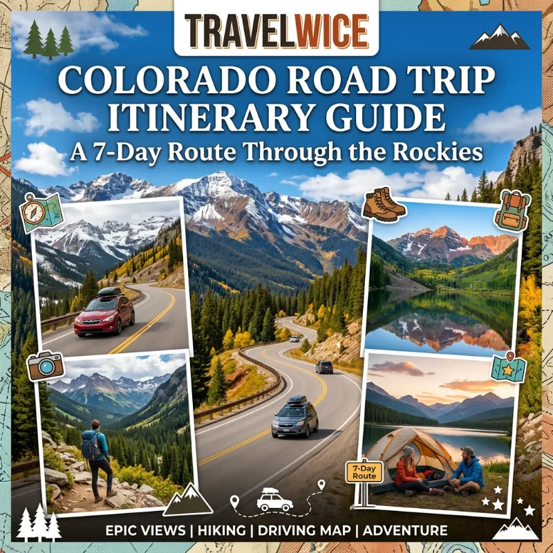
The loop also follows the logic of the land. You start with the high plains, climb into the Front Range, cross the Divide twice, and drop back down near Pikes Peak. As a result, the scenery changes every day, and you never backtrack.
Here is the plan at a glance.
| Day | Route | Miles | Drive Time | Main Highlight |
|---|---|---|---|---|
| 1 | Denver to Boulder to Estes Park | 95 | 2.5 hrs | Peak to Peak Highway |
| 2 | Estes Park to Grand Lake to Breckenridge | 120 | 3.5 hrs | Trail Ridge Road |
| 3 | Breckenridge to Aspen | 110 | 3 hrs | Independence Pass |
| 4 | Aspen (local day) | 40 | 1.5 hrs | Maroon Bells |
| 5 | Aspen to Crested Butte | 100 | 3 hrs | Kebler Pass |
| 6 | Crested Butte to Salida to Colorado Springs | 200 | 4.5 hrs | Monarch Pass |
| 7 | Colorado Springs to Denver | 75 | 1.5 hrs | Garden of the Gods |
These numbers are estimates. Road work, wildfire smoke, and weather can add time, so check CDOT’s CoTrip map each morning.
Best Time to Take a Colorado Mountain Loop Road Trip
Timing matters more here than almost anywhere in the US. Trail Ridge Road usually opens around Memorial Day and closes around mid October. Independence Pass is a seasonal road too. It generally closes for winter in early November. Because the dates shift with snow, always confirm before you book nonrefundable hotels.
| Season | Pros | Cons | Verdict |
|---|---|---|---|
| Late May to mid June | Fewer crowds, green valleys | Some passes still closed, cold nights | Risky |
| Late June to August | All roads open, long days, wildflowers | Afternoon thunderstorms, highest prices | Best for first timers |
| September | Golden aspens, cooler days, thinner crowds | First snow possible above 11,000 feet | My favorite |
| October | Cheapest rates | Pass closures, early snow | Only with flexibility |
I lean toward the second half of September. Aspens turn gold from roughly mid to late September in the high country, and hotel rates drop after Labor Day. Just pack layers, because mornings at 9,000 feet can start near freezing.
Start your thunderstorm plan early. In July and August, storms build almost every afternoon above treeline. So hike high trails in the morning and save driving or museums for later.
Colorado Road Trip Itinerary Guide: Elevation Cheat Sheet
Altitude affects sleep, headaches, and even how your car feels on steep grades. Denver sits at 5,280 feet. Most of this loop sits well above that. Look at how the key points compare.
| Place | Elevation (ft) | Chart |
|---|---|---|
| Denver | 5,280 | ▇▇▇ |
| Colorado Springs | 6,035 | ▇▇▇▇ |
| Estes Park | 7,522 | ▇▇▇▇▇ |
| Aspen | 7,908 | ▇▇▇▇▇ |
| Breckenridge | 9,600 | ▇▇▇▇▇▇ |
| Crested Butte | 8,909 | ▇▇▇▇▇▇ |
| Monarch Pass | 11,312 | ▇▇▇▇▇▇▇ |
| Independence Pass | 12,095 | ▇▇▇▇▇▇▇▇ |
| Trail Ridge Road (high point) | 12,183 | ▇▇▇▇▇▇▇▇ |
So plan to drink more water than you think you need. Skip heavy drinking on night one. Also keep your first two days light, since your body needs time to adjust.
Day 1: Denver to Estes Park via the Peak to Peak Highway
Pick up your rental car at Denver International Airport and leave the city before noon. Rush hour on I-25 and US-36 can add 45 minutes, so an early start pays off.
Stop 1: Boulder for a Late Breakfast
Boulder is 45 minutes from the airport area, and it makes an easy first stop. Walk the Pearl Street Mall, grab a coffee, and stretch your legs. Parking in the garages costs a few dollars an hour, and the Flatirons make a free backdrop.
If you have extra time, hike the short Chautauqua Trail. It takes about an hour round trip and gives you a first taste of Colorado air.
Stop 2: The Peak to Peak Highway
From Boulder, take CO-119 up Boulder Canyon, then join CO-72 and CO-7 north. This is the Peak to Peak Scenic Byway, which runs along the edge of the Indian Peaks Wilderness. You will pass old mining towns like Nederland and Ward, plus views of Longs Peak at 14,259 feet.
Stop at Allenspark for lunch if you want a quiet break. The road is paved and well kept, though it twists a lot, so keep your speed low.
Where to Sleep in Estes Park
Estes Park is the gateway to Rocky Mountain National Park. Prices run about $140 to $260 per night in summer for a clean mid-range motel or small lodge. Book early for weekends.
For dinner, try a local brewery and watch for elk. In fall, bull elk wander through town during the rut, and they can be dangerous. Keep at least 75 feet away, and never block their path.
For a deeper look at the park, our Rocky Mountain National Park guide covers trails, rules, and wildlife.
Day 2: Trail Ridge Road to Grand Lake and Breckenridge
Day 2 is the big scenic day. Trail Ridge Road is a 48-mile highway across Rocky Mountain National Park, and it reaches 12,183 feet. Few paved roads in the US sit this high.
Before You Go
The park has used timed entry reservations in recent summers. The rules change from year to year, so check the National Park Service page for Rocky Mountain National Park before you leave home. Reservations often open in spring and can sell out for peak days.
Also note a big change for overseas visitors. The NPS announced new 2026 pricing that adds a higher fee for non-US residents at some popular parks, and it also raised the price of the annual pass for them. Rocky Mountain is on that list, so read the latest fee page before you budget. UK and European travelers should run the numbers for a single park visit against the annual pass.
The Drive
Start by 7:30 a.m. The light is better, the traffic is lighter, and storms stay away. Here is a simple order for the day.
- Enter the park from Estes Park on US-34.
- Stop at Many Parks Curve for the first big view.
- Walk the short Forest Canyon Overlook trail.
- Stop at the Alpine Visitor Center near the top, but expect a crowd.
- Drop down the west side and look for moose near the Colorado River.
- Have lunch in Grand Lake, a small lakeside town with a boardwalk.
The road has steep drop-offs and few guardrails in places. For that reason, passengers get the best views, and drivers should keep their eyes ahead.
Drive to Breckenridge
From Grand Lake, take US-34 to Granby, then US-40 and CO-9 south to Breckenridge. Expect about two hours without stops. You will pass Green Mountain Reservoir, which makes a good photo break.
Breckenridge is a former mining town with Victorian buildings and a lively Main Street. It also ranks among the state’s busiest ski towns. If winter trips interest you, read our list of the best ski towns in Colorado.
Rooms cost $180 to $320 per night in summer. Staying in nearby Frisco or Dillon often saves $40 to $80 per night, and you still reach Breck in 15 minutes.
Day 3: Breckenridge to Aspen Over Independence Pass
This is the day I tell friends not to miss. Independence Pass crosses the Continental Divide at 12,095 feet on CO-82. Vehicles longer than 35 feet are not allowed on the narrow western side, so skip it with a big RV.
The Route
Leave Breckenridge around 9 a.m. Drive north to Frisco, west on I-70 to Copper Mountain, then south on CO-91 to Leadville. Leadville, at 10,152 feet, is the highest incorporated city in the US. Stop there for a short walk along Harrison Avenue and a coffee.
From Leadville, follow US-24 north and then CO-82 west up to the pass. The road narrows, the trees vanish, and the world opens up. Pull into the Independence Pass summit lot, and walk the short loop trail. It is only about 0.4 miles, but the air will feel thin.
Arriving in Aspen
The descent into Aspen is steep, so shift to a lower gear and avoid riding your brakes. You will pass Independence ghost town about 15 miles before Aspen, and it makes a quiet stop.
Aspen has a reputation for being very expensive, and that is fair. Summer rooms often run $350 to $700 per night. To save money, look at Basalt or Carbondale, which sit 20 to 30 minutes away. Many travelers book a base there and drive in each morning.
Eat well but smartly. Lunch at a casual spot costs about $18 to $28, while dinner at a top restaurant can pass $100 per person. Our guide to things to do in Aspen shows where locals eat and where to find free views.
Day 4: Maroon Bells and a Slow Day in Aspen
Day 4 gives your body and your car a break. The Maroon Bells are twin peaks above 14,000 feet, and they are among the most photographed mountains in North America. Maroon Lake sits at their base.
How Access Works
In summer and early fall, you cannot simply drive up. Most visitors reserve a shuttle or a vehicle pass, and the system runs on a schedule that changes each year. Check the official Aspen and White River National Forest pages, and book as soon as dates open. Sunrise slots sell out first, but they are also the best for photos.
A Simple Plan for the Day
- Take an early shuttle to Maroon Lake and walk the flat lakeside path.
- Continue to Crater Lake, an easy 3.6 mile round trip with big views.
- Return to town for lunch and a nap.
- Ride the Silver Queen Gondola up Aspen Mountain in the afternoon.
- Finish with a walk through the town center and a sunset drink.
If you feel adventurous, hike toward Buckskin Pass. It is a hard, long day above 12,000 feet, and it is not for beginners. Start before 6 a.m., because lightning is common after noon.
Good news for tired drivers: you will not need your car except for a grocery run. That is why I put this rest day in the middle of the plan. Fatigue is a real risk on mountain roads, and a day without driving makes the rest of the loop safer.
Day 5: Aspen to Crested Butte Over Kebler Pass
Crested Butte is often called the last great Colorado ski town, and in summer it earns a second title: wildflower capital. The drive there is the most rewarding in the loop, as long as you pick the right road.
Kebler Pass or the Long Way
Kebler Pass is a mostly graded dirt road that cuts through one of the largest aspen groves in North America. In late September, the trees glow gold on both sides. A regular sedan can handle it in dry weather, but go slowly and skip it after heavy rain.
If you prefer pavement, drive via Carbondale, Glenwood Springs, and Gunnison instead. It adds about an hour. For most travelers, though, Kebler is worth the dust.
Things to Do in Crested Butte
- Walk Elk Avenue, the colorful main street, and browse the small shops.
- Hike the Lower Loop trails for easy, flat walks near town.
- Drive to Gothic, a research town, and see Mount Crested Butte up close.
- Eat a late lunch and watch the evening light on the Elk Mountains.
Crested Butte stays quieter than Aspen or Breckenridge, and prices are lower. Expect $170 to $300 per night in peak season. Because the town sits at the end of the road, the crowds stay smaller, and that is exactly why I like it.
Day 6: Crested Butte to Colorado Springs via Monarch Pass
This is your longest driving day, at roughly 200 miles. Still, the route keeps changing, and you cross the Divide a final time. Start by 8 a.m. so you reach Colorado Springs with daylight to spare.
The Route
Drive south to Gunnison, then east on US-50 over Monarch Pass at 11,312 feet. A gondola near the top takes you to a 12,000 foot overlook in summer, and it makes a fun break for kids. Next, drop into Salida, a creative river town on the Arkansas River.
Stop in Salida for lunch. Walk along the river and visit the historic downtown. Many travelers love it more than the famous mountain resorts, and it costs far less.
From Salida, take US-50 east through the Arkansas River canyon. You will pass Cañon City, home of the Royal Gorge Bridge, then continue to Colorado Springs. If you have extra time and a love of sand, Great Sand Dunes National Park sits about 90 minutes southeast of Salida. It works as a detour, but it adds a full day, so only add it if you stretch the trip to 8 days. The National Park Service page for Great Sand Dunes lists current conditions.
Evening in Colorado Springs
Colorado Springs gives you a big change of scene. After mountain towns, you get wide streets, red rocks, and cheaper hotels at about $120 to $220 per night. Eat dinner downtown and rest well. Tomorrow is easy.
Day 7: Garden of the Gods and the Drive Back to Denver
The final day is short, so you have time for one more highlight and a calm return. Start at Garden of the Gods, a free city park with huge red sandstone formations. Arrive before 9 a.m. for the best light and easy parking.
Walk the Perkins Central Garden Trail. It is paved, about 1.5 miles, and works for most ages. After that, decide how much you want to do.
- Short on time: visit Garden of the Gods, then drive north to Denver.
- More time: add Pikes Peak, the 14,115 foot summit that inspired “America the Beautiful.” The highway and cog railway both need advance reservations in peak season.
- Foodie option: stop in Manitou Springs for lunch and a walk past the old mineral springs.
Our things to do in Colorado Springs guide has more options and a few rainy day ideas.
Drive north on I-25 and plan for 75 miles and about 90 minutes. Traffic through Castle Rock and south Denver can slow you down, particularly on Friday and Sunday afternoons. Leave Colorado Springs by 11 a.m. if you have a late flight, and return your rental car at least three hours before departure.
Colorado Mountain Loop Road Trip: Driving Tips for High Passes
You do not need special skills to drive these roads. You do need patience and a few good habits. These are the ones that matter most.
- Fill your tank whenever it drops below half. Gas stations get rare between towns, and prices rise in remote areas.
- Use a low gear on long descents, so your brakes do not overheat.
- Start early. Afternoon storms, wildlife, and traffic all build after noon.
- Pull over to let faster cars pass on narrow roads. Use the signed turnouts.
- Check CoTrip each morning for closures, chain laws, and wildfire alerts.
- Download offline maps. Cell service drops on most passes.
Wildlife also needs your attention. Elk, deer, and bighorn sheep cross roads at dawn and dusk. Slow down in those hours and give animals plenty of space.
Altitude sickness is the other big risk. Headache, nausea, and poor sleep are common signs. Drink water, eat light meals, and rest if you feel unwell. If symptoms get worse, move to a lower elevation and see a doctor.
Colorado Road Trip Budget Tips and Real Costs
Colorado is not cheap, but smart choices can cut the bill by 25 to 35 percent. Here is a mid-range estimate for two adults on the 7-day loop. These are planning numbers based on typical summer prices, so check live rates before you book.
| Category | Budget | Mid-Range | Comfortable |
|---|---|---|---|
| Lodging (6 nights) | $900 | $1,500 | $2,600 |
| Rental car (7 days, mid-size) | $450 | $600 | $850 |
| Gas (about 700 miles) | $90 | $120 | $150 |
| Food | $450 | $700 | $1,100 |
| Park fees and activities | $100 | $200 | $350 |
| Parking and extras | $60 | $100 | $200 |
| Total for two | $2,050 | $3,220 | $5,250 |
In pounds, the mid-range total comes to roughly £2,550 at recent exchange rates, and in euros close to €2,950. Exchange rates move, so use a live converter before you plan.
Try these tricks to save money.
- Book Aspen and Breckenridge early, or sleep in Basalt, Frisco, or Dillon.
- Pick a hotel with free breakfast. It saves about $20 to $30 a day.
- Buy groceries in Denver or Boulder for picnic lunches. Mountain town stores charge more.
- Travel in September or early October, when rates fall.
- Compare a one-way rental to a round trip. Most loops start and end in Denver, so a round trip usually costs less.
- If you visit several US parks in one trip, compare single entry fees with the annual pass.
When it comes to car rental, book the smallest car you will be comfortable in, then check for AWD only if you travel in spring or late fall. Gas stays a small part of the budget. Lodging is the real cost.
Colorado Road Trip Packing List
Good packing makes the loop easier, and Colorado weather changes fast. Because you will see 90 degree afternoons and 30 degree mornings in the same week, layers matter most.
Clothing
- Light rain jacket or shell
- Warm fleece or puffy jacket
- Two or three moisture-wicking shirts
- Hiking pants and one pair of shorts
- Comfortable hiking shoes or boots
- Warm hat and light gloves for passes and early mornings
- Sun hat and sunglasses
Gear and Safety
- Reusable water bottle, at least one liter each
- Sunscreen with SPF 30 or higher, since UV is strong at altitude
- Lip balm and moisturizer for dry air
- Basic first aid kit and any personal medicine
- Phone mount, charger, and offline maps
- Paper map as a backup
- Small daypack and trekking poles if you like them
- Snacks and a cooler for long stretches
For the Car
- A full tank, and a habit of keeping it above half
- Jumper cables and a flashlight
- Windshield cleaner, and a blanket for cold mornings
- Ice scraper if you travel in late September or later
Everyone forgets one thing: a way to carry extra water during long drives. Keep a gallon in the trunk. It helps for hikes, and it helps for overheated engines too.
Common Mistakes to Avoid
I see the same errors again and again, and they are all easy to fix.
- Trying to see too much in a day. Cut a stop before you cut sleep.
- Skipping reservations for Maroon Bells, park entry, or Pikes Peak.
- Starting hikes after 11 a.m. in summer and meeting lightning.
- Ignoring altitude on day one.
- Leaving food in the car at trailheads where bears are active.
- Booking Aspen last, when rooms are gone or very high.
Some travelers also ask me about driving the loop clockwise or counterclockwise. Clockwise, as written here, puts the highest drive early, which helps you adjust slowly. It also finishes with the easiest day. For further route ideas, see the Road Trip Locals Colorado guide, the Travel Nation Rocky Mountains road trip ideas, and the Honeytrek Colorado road trip post. Each takes a slightly different path, so you can borrow stops you like.
How to Shorten or Extend the Route
| Trip Length | What to Change |
|---|---|
| 5 days | Drop Crested Butte. Go Aspen to Glenwood Springs to Denver |
| 7 days | Follow this plan exactly |
| 10 days | Add Great Sand Dunes, Mesa Verde, or Steamboat Springs |
For planning other seasons and regions, the main TravelWice site has more Colorado and US guides, and the official Colorado tourism site has event dates and seasonal alerts.
Frequently Asked Questions
How many days do you need for a Colorado road trip?
Seven days gives you a relaxed loop with time for one national park and several mountain towns. Five days works if you cut Crested Butte. Ten days lets you add more parks.
What is the best Colorado road trip route for first timers?
The Denver, Estes Park, Breckenridge, Aspen, Crested Butte, Colorado Springs loop in this guide suits first timers. It has easy roads, famous views, and a rest day in the middle.
When is the best time to drive over Independence Pass and Trail Ridge Road?
Late June to mid October is the usual window. Both roads close in winter, and the dates change with snowfall. Check official road reports before you go.
Do I need a 4WD or AWD car?
Not in summer. A normal car handles every paved road on this loop. Only Kebler Pass is gravel, and it is fine for most cars in dry weather. In spring or after the first snow, AWD gives extra comfort.
How much does a 7-day Colorado road trip cost?
Two travelers should plan on about $2,000 to $5,000, depending on hotel style. Most of that goes to lodging.
Is altitude a problem for road trippers?
It can be. Many visitors feel mild headaches or poor sleep above 8,000 feet. Drink water, eat light, and take the first day slowly.
Can I do this trip in winter?
Not as written. Trail Ridge Road and Independence Pass close, so a winter trip needs a different route and snow driving skills.
Quick Quiz: Test Your Colorado Road Trip Knowledge
1. How high is Trail Ridge Road at its highest point?
A. 9,500 feet
B. 12,183 feet
C. 14,115 feet
2. Which pass crosses the Continental Divide on the way into Aspen from Leadville?
A. Monarch Pass
B. Kebler Pass
C. Independence Pass
3. What is the best time to avoid afternoon storms on high trails?
A. Early morning
B. Late afternoon
C. After sunset
4. Which town is the final overnight stop on this loop?
A. Colorado Springs
B. Boulder
C. Salida
5. How far should you stay from wild elk?
A. 10 feet
B. 30 feet
C. At least 75 feet
Answers: 1 = B. 2 = C. 3 = A. 4 = A. 5 = C.
Final Thoughts on This Colorado Road Trip Itinerary Guide
A good Colorado trip does not need a long list of stops. It needs the right order, a few early mornings, and room to breathe. This Colorado road trip itinerary guide gives you that structure, from the Peak to Peak Highway to the red rocks of Garden of the Gods.
Plan the three bookings that sell out first, which are Aspen lodging, Maroon Bells access, and park entry. Pack layers, fill your tank often, and keep every day simple. Then leave a little space for the views you did not expect, because those are the ones you will remember. If you want to dig deeper before you go, open our Colorado travel guide for 2026 next.
References
- National Park Service, Rocky Mountain National Park: https://www.nps.gov/romo/index.htm
- National Park Service, Great Sand Dunes National Park: https://www.nps.gov/grsa/index.htm
- Colorado Department of Transportation, CoTrip road conditions: https://www.cotrip.org/
- Colorado Tourism Office: https://www.colorado.com/
- Road Trip Locals, Ultimate Colorado Road Trip: https://www.roadtriplocals.com/blog/ultimate-colorado-road-trip
- Travel Nation, Rocky Mountains Colorado Road Trip: https://travelnation.co.uk/blog/incredible-places-to-visit-on-a-rocky-mountains-colorado-road-trip
- Honeytrek, Colorado Road Trip: https://www.honeytrek.com/colorado-road-trip/
- TravelWice, Colorado Travel Guide for 2026: https://travelwice.com/colorado-travel-guide-for-2026/