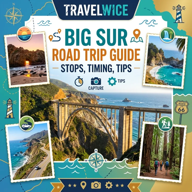

Ask any traveler who has driven the California coast, and they will tell you the same thing. Nothing quite prepares you for your first turn onto Highway 1 through Big Sur. This big sur road trip guide comes from someone who has actually driven the route more than once. I have watched fog swallow the cliffs at 7 a.m., paid too much for a campsite, and learned the hard way that gas stations disappear for miles at a time. Big Sur is not a place you rush. It rewards travelers who slow down, check road conditions first, and build flexibility into their plans, especially in 2026, when wildfire closures have reshaped the route more than once.
Before you go further, here is the quick version.
TL;DR
Big Sur runs roughly 90 miles along Highway 1 between Carmel and San Simeon, and most travelers need at least two full days to enjoy it properly.As of late August 2026, a stretch of the highway is closed because of wildfire activity, so you must check current conditions before you leave home.Camping ranges from about $30 a night for a basic tent site to over $300 for a private cabin, and reservations often fill up six months in advance.
| Key Takeaway | What It Means For You |
|---|---|
| Best time to drive Big Sur | Late April through early June, or September through October, for lighter crowds and clearer skies |
| Ideal trip length | 2 to 3 days, though a rushed one-day version is possible if you start early |
| Current road status | Partially closed near Ragged Point as of August 2026 due to wildfire; always confirm with Caltrans before departure |
| Camping budget | $30 to $110 per night for tent or RV sites; $175 and up for cabins or glamping tents |
| Must-check resource | Big Sur California official site for real-time closures and park status |
What a Big Sur Road Trip Actually Looks Like in 2026
Big Sur is the wild, undeveloped stretch of California’s central coast. It runs from Carmel-by-the-Sea in the north down to San Simeon in the south. It is roughly 90 miles long, and Highway 1 hugs the cliffs the entire way. Because of that, the drive itself becomes the destination rather than just a way to get somewhere. This is not a highway you speed through. You will want to stop constantly, so budget far more time than a map app tells you.
Joshua Tree National Park Guide for 2026 Everything You Need to Plan Your Trip
The Current Road Closure You Need to Know About
Here is something most guides gloss over, and it matters a lot right now. As of late August 2026, wildfires known as the Timber Fire and Plaskett Fire forced a full closure of roughly 70 miles of Highway 1. The closed stretch runs from near Ragged Point up toward the Little Sur River, and several state parks in that zone closed too. This follows years of intermittent closures caused by landslides and storm damage. One stretch was even shut for repairs for nearly three years before it reopened in January 2026. In short, checking conditions is not optional anymore. It is the single most important step in planning this trip. Before anything else, check the Caltrans QuickMap and the Big Sur California community site the morning you leave, since conditions can change overnight.
What To Do If the Route Is Closed
If the coastal route is closed when you travel, Highway 101 through Salinas and Paso Robles works as a detour. You will miss the ocean views, but you will still reach your destination. Many travelers pair this drive with stops further afield. If your itinerary also includes San Francisco, browse our guide to things to do in San Francisco before you head south. If Los Angeles is your starting or ending point, our things to do in Los Angeles guide can help you bookend the drive.
On a visit a few years back, Highway 1 was fully open except for one state park. The drive still took an entire day longer than planned, simply because every pullout demanded a stop. Since then, closures have come and gone more than once. Each time the road reopens, locals treat it like a genuine event. That pattern is worth remembering. This landscape is beautiful, but it is also actively changing, with erosion and wildfire risk shaping which sections stay open. Travelers who build a buffer day into their schedule rarely regret it. Those who plan a tight, back-to-back itinerary sometimes end up rerouting at the last minute.
Lake Tahoe Travel Guide 2026 What to Know Before You Go
The Santa Lucia Mountains rise almost straight out of the Pacific here. That creates dramatic cliffside views, but it also means the highway sits on unstable ground. Heavy winter rain loosens soil above the road. Dry summer vegetation, meanwhile, turns into wildfire fuel once temperatures climb. Neither of those forces is going away. So treating road status as a fixed fact, rather than something to double check, is the single biggest planning mistake first-time visitors make.
Best Time to Drive Big Sur
Timing genuinely changes this trip. Because Big Sur sits right on the coast, the weather shifts fast, and fog is a daily visitor rather than an occasional nuisance.
Big Sur by Season
Spring (April to May) brings waterfalls at full flow and green hillsides. The Calla Lily Valley in Garrapata State Park blooms from late January through mid-April. Rain has mostly tapered off by May, though mornings stay cool and foggy.
Summer (June to August) is the busiest and most crowded season. Daytime highs sit in the mid to high 70s Fahrenheit, or roughly 24 to 26°C. Traffic backs up at popular pullouts, and parking at places like Pfeiffer Beach fills before 10 a.m. On the upside, this is also peak season for spotting blue whales and humpback whales offshore.
Best Time to Visit California by Region A Local’s Month-by-Month Guide
Fall (September to October), often called Big Sur’s Indian Summer, is arguably the best time drive big sur enthusiasts recommend. Skies clear and temperatures stay warm without the summer crowds. The light for photography also turns genuinely dramatic in the late afternoon.
Winter (November to March) is storm season, and this is when landslides most often close sections of the highway. It is also gray whale migration season, though, with roughly 12,000 whales passing the coast between Alaska and Baja California. You can spot them from clifftop viewpoints like Point Sur. Accommodation prices also drop by around 20 percent in winter, so budget travelers should not rule it out.
Rainfall and Whale Watching at a Glance
Here is a quick month by month snapshot of what to expect.
Rainy Days per Month (approximate)
Jan  ██████████ 10
Feb  ███████████ 11
Mar  ███████ 7
Apr  ████ 4
May  ██ 2
Jun  █ 1
Jul  0
Aug  0
Sep  █ 1
Oct  ██ 2
Nov  █████ 5
Dec  █████████ 9
April through October is by far the driest stretch. That is why most travelers plan their big sur road trip guide research around those months. If whale watching is your priority, however, winter still wins despite the wetter roads.
| Whale Species | Peak Months | Best Viewpoints |
|---|---|---|
| Gray whales (southbound) | December to February | Garrapata State Park, Point Sur |
| Gray whales (northbound) | March to May | Point Sur Lighthouse |
| Humpback whales | July to October | Ragged Point, offshore pullouts |
| Blue whales | June to September | Offshore, best spotted from boat tours |
None of these sightings are guaranteed, since whales follow food rather than a fixed calendar. Pairing your visit with the right season, though, noticeably improves your odds. Some travelers plan their entire trip around whale season rather than around weather alone. Honestly, that is a reasonable trade-off if wildlife is your priority.
Budget Shifts With the Season
Hotel and cabin rates along the coast often drop by 15 to 20 percent between November and February. Demand falls, even though the scenery arguably gets more dramatic during storms. Summer weekends, meanwhile, can require booking three to six months ahead for anything decent. That applies whether you want a campsite or a room at a lodge like Big Sur Lodge or Glen Oaks. If flexibility matters more than good weather, shoulder season is your best bet. Late April to early June, or mid-September to late October, tends to offer the best balance of price, crowd size, and clear skies.
Big Sur Itinerary: 1 Day vs Multiple Days
Plenty of people search for a big sur itinerary 1 day plan, because that is all the time their broader California trip allows. It is doable, but it means picking a handful of stops instead of trying to see everything.
A Realistic One-Day Itinerary
Here is a realistic one-day plan, driving north to south from Carmel.
- Start at Bixby Creek Bridge by 8 a.m., before tour buses arrive and while morning light still hits the arch.
- Continue to Point Sur State Historic Park for a quick photo stop, then keep driving toward Pfeiffer Big Sur State Park.
- Walk the short, mostly flat trail to Pfeiffer Falls, which takes about 45 minutes round trip.
- Grab lunch at the Big Sur River Inn or Nepenthe, both of which sit right along the highway.
- Head to Pfeiffer Beach in the early afternoon to see the purple-tinged sand and the famous keyhole rock arch.
- Finish at the McWay Falls pullout, since the main overlook trail is closed for a retaining wall project, though the roadside view still delivers the iconic shot.
- Turn back north before sunset, since the switchbacks get genuinely difficult to navigate after dark.
A single day means constant driving with only brief stops, and you will likely feel rushed. If your schedule allows it, two to three days lets you actually hike, relax on a beach, and avoid racing the sunset. Many travelers combine this with a broader loop through California. Our California travel guide for 2026 breaks down how Big Sur fits into a longer coastal itinerary alongside stops like Yosemite or Napa.
A More Relaxed 3-Day Version
For comparison, here is a slower three-day version of the same drive.
- Day 1: Drive from Carmel to Pfeiffer Big Sur State Park, stopping at Bixby Bridge and Point Lobos along the way. Check into a campground or cabin by early afternoon, then hike the short loop to Pfeiffer Falls before dinner.
- Day 2: Spend the morning at Pfeiffer Beach, then drive south to McWay Falls and Partington Cove. Save the afternoon for the Ewoldsen Trail, a moderate 4.5-mile loop through redwoods with coastal overlooks, and watch the sunset near Limekiln State Park.
- Day 3: Continue south toward Ragged Point for breakfast with an ocean view. From there, either turn back north or continue toward San Simeon and Hearst Castle if your trip extends further down the coast.
Spreading the drive over three days changes the entire experience. Instead of treating each stop as a box to check, you get time to actually sit at a beach or finish a hike without watching the clock. Families traveling with kids tend to find the slower pace far less stressful, since toddlers and long car rides rarely mix well on a rushed schedule.
Best Stops on Highway 1 California
There is no shortage of viewpoints along this road. A handful of stops, though, consistently rank as the best stops highway 1 california travelers ask about.
The Must-See Stops
- Bixby Creek Bridge: An open-spandrel arch bridge that soars 260 feet above the canyon floor. Photograph it from the designated pullout just south of the bridge, not by standing on it.
- Point Lobos State Natural Reserve: Just north of Big Sur proper, this reserve is known for sea lions, otters, and cypress groves. It pairs easily with a stop at Carmel Beach.
- McWay Falls: An 80-foot waterfall that drops directly onto a small beach. The closest official trail is currently closed for construction, so plan for a roadside pullout view instead.
- Pfeiffer Beach: Known for its purple sand, caused by manganese garnet deposits washing down from the hills. Its keyhole rock arch frames sunset light in December and January.
- Partington Cove: A short but steep hike through a hand-carved tunnel that opens onto a rocky cove. It sees far fewer crowds than the beach stops.
- Ragged Point: The last reliable gas stop for a long stretch if you are heading south, plus a good lunch break with sweeping ocean views.
- Andrew Molera State Park: A quieter alternative to Pfeiffer Beach, with a flat coastal trail and far fewer crowds. It’s a solid pick during peak summer months.
- Nepenthe and Café Kevah: Not a natural landmark, but worth mentioning. The terrace view from Nepenthe genuinely earns its reputation as a lunch stop roughly halfway through a north to south drive.
- Julia Pfeiffer Burns State Park: Home to McWay Falls, but also worth a stop for the Ewoldsen Trail if you want redwood forest views without the beach crowds.
Planning Your Stops
Each of these stops takes anywhere from ten minutes to two hours. Plan your day around three or four rather than trying to squeeze in all of them. Parking fills up fast at the popular ones, particularly Pfeiffer Beach and McWay Falls, so arriving before 10 a.m. genuinely makes a difference.
If you are extending your trip north toward the Bay Area afterward, it is worth adding a detour into wine country. Our Napa Valley wine country guide is a natural add-on for travelers flying in or out of San Francisco.
Big Sur Camping Options
For travelers who want to sleep under redwoods rather than in a hotel room, big sur camping options range widely in both style and price. Reservations fill up fast, sometimes six months ahead for summer weekends. Book early through ReserveCalifornia or the individual campground’s own site.
Campground Price Comparison
| Campground | Type | Typical Price per Night | Notes |
|---|---|---|---|
| Pfeiffer Big Sur State Park | Standard/premium tent & RV | $50 to $60 | Riverfront redwood setting; books out fast in summer |
| Kirk Creek Campground | Tent/RV, ocean bluff | Around $35 | First-come, first-served options nearby at Ponderosa Campground |
| Limekiln State Park | Tent, redwoods and ocean | $30 to $45 | Close to historic limekiln ruins |
| Riverside Campground and Cabins | Tent, RV, cabins | $70 to $75 (tent) | River access, close to restaurants |
| Fernwood Campground and Resort | Tent, RV, adventure tents, cabins | $50 to $355 depending on style | Most flexible options for groups and families |
| Andrew Molera State Park | Trail/walk-in tent sites | Around $30 | Requires a short walk from the parking area |
Cell reception is close to nonexistent through most of Big Sur, so download offline maps and confirm your reservation details before you lose signal. If camping is not your style, cabins and lodges like Big Sur Lodge or Glen Oaks sit right along the highway. They cost considerably more, often $200 to $900 a night depending on the season.
Camping Tips Worth Knowing
A few smaller details tend to catch first-time campers off guard. Several private campgrounds charge extra fees for additional guests or a second vehicle, sometimes $5 to $15 per person or car beyond the base rate. Read the fine print before booking. Firewood collection is also restricted in most state parks, so you will likely need to buy bundles on-site rather than gather your own. Wildlife sightings, including skunks, raccoons, and the occasional deer wandering through camp, are common. Store food properly and treat it as part of the experience rather than a surprise.
For travelers who prefer not to camp at all but still want that redwood-forest feel, glamping style adventure tents split the difference. Places like Fernwood Resort offer real beds and structure without the full hotel price tag, typically in the $175 to $195 per night range.
Practical Tips for Driving Highway 1 Through Big Sur
A few lessons tend to repeat themselves for first-time visitors, so here is what actually helps.
Before You Go
- Fill up early. Gas stations are sparse between Carmel and Cambria, and prices climb the further south you go.
- Rent a smaller car if you can. Some pullouts and parking areas are tight, and larger SUVs or RVs struggle on the sharper switchbacks.
- Check road status the morning of your trip, not the week before. Closures related to wildfire, landslide, or storm damage can appear with little warning.
- Book restaurants ahead in summer. Options along the route are limited, and popular spots like Nepenthe can mean a long wait without a reservation.
On the Road
- Expect fog in the morning. Coastal fog often burns off by late morning, so starting too early can mean missing the views entirely, though it does make for moody photography.
- Drive north to south if photos matter most to you. That direction puts the ocean on your side of the car for unobstructed stops.
- Watch for cyclists and pullouts. The road is narrow with tight curves, so only stop at marked pullouts, never on blind corners.
- Pack cash. Some smaller cafes and parking areas along the route still do not accept cards reliably, given the patchy internet service.
- Bring layers, always. Coastal temperatures swing widely between a foggy morning and a sunny afternoon.
None of these tips are complicated, but together they solve most of the frustrations first-time visitors report after their trip. A little preparation goes a long way on a road this beautiful and this unpredictable.
If your West Coast trip also includes a stop further south, our guide to things to do in San Diego rounds out a longer coastal itinerary. Travelers heading inland afterward often continue on to our Yosemite National Park travel guide for a mountain contrast to the coast.
For additional trip reports from travelers who have driven this route recently, Sarah Vogt’s Big Sur road trip account and Live Like It’s the Weekend’s Big Sur guide both offer honest, firsthand notes worth reading before you go.
Frequently Asked Questions
Trip Planning Questions
Is Highway 1 open through Big Sur right now? It depends on the month you are reading this. As of late August 2026, a roughly 70-mile stretch is closed due to wildfire activity. Always check the Caltrans QuickMap and the Big Sur California site before departure.
How many days do you need for a Big Sur road trip? Two to three days is the sweet spot for most travelers. A single day works if you are simply passing through, but you will only manage a handful of stops.
Is Big Sur good for a one day trip from San Francisco? Yes, though it makes for a long day. The drive from San Francisco to the heart of Big Sur takes about three hours each way, so an early start matters.
What is the best month to drive Big Sur? September and October generally offer the clearest skies and fewer crowds. April and May bring waterfalls and wildflowers if scenery matters more to you than crowd size.
Logistics Questions
Do I need reservations for Big Sur camping? For popular state park campgrounds, yes, often months in advance during summer. A few first-come, first-served sites exist, but do not count on finding one during peak season.
Can you drive Big Sur in a regular car, or do you need something bigger? A regular sedan or small SUV handles the drive fine. The road is paved and well maintained where it is open, though the curves are sharp enough that larger RVs move noticeably slower.
Is there cell service in Big Sur? Barely, and this catches a lot of visitors off guard. Coverage is patchy through most of the drive, so download offline maps and save your campground confirmation before you lose signal.
Quick Knowledge Check
Test what you just learned about planning a Big Sur road trip.
1. Roughly how long is the Big Sur stretch of Highway 1? A) 30 miles B) 90 miles C) 200 miles Correct answer: B, roughly 90 miles between Carmel and San Simeon.
2. Which season typically brings the clearest, driest weather to Big Sur? (select all that apply) A) Fall B) Late summer C) Winter Correct answers: A and B, since rainfall drops sharply from June through October.
3. What caused the major Highway 1 closure reported in late August 2026? A) A landslide B) Wildfire activity C) A bridge collapse Correct answer: B, the Timber Fire and Plaskett Fire.
4. Which of the following are legitimate Big Sur camping options? (select all that apply) A) Pfeiffer Big Sur State Park B) Kirk Creek Campground C) A hotel in downtown Fresno Correct answers: A and B.
5. Why is checking road conditions before departure so important in Big Sur? (select all that apply) A) Cell service is unreliable once you arrive B) Closures from wildfire, landslides, or storms can happen with little warning C) Big Sur never experiences road closures Correct answers: A and B.
Conclusion
A Big Sur road trip rewards patience more than speed. The best stops, from Bixby Bridge to Pfeiffer Beach, matter less than the flexibility you build into your plans. Wildfire and storm closures have become a regular part of traveling this coast, so plan around them rather than against them. Check current road status before you leave, book your campsite early if you want one, and give yourself more time than you think you need. Do that, and this drive will likely become the trip you talk about for years afterward.
References
- Big Sur California, official community and closure updates
- Sarah Vogt, Big Sur Road Trip firsthand guide
- Live Like It’s the Weekend, Big Sur Road Trip guide
- Caltrans QuickMap, live road conditions
- California State Parks, Big Sur area fees and information
- Visit California, Highway 1 Santa Cruz to Big Sur road trip