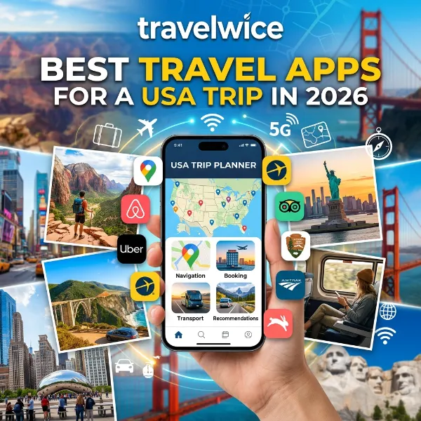

I have watched too many travelers land at JFK or LAX with twelve apps on their phone. They have no plan for which one actually helps once the signal drops. If you want the best travel apps for USA travel this year, you need fewer apps, not more. You need the right ones working together. This guide walks through exactly what to load onto your phone before you touch down. It’s based on what actually holds up on the road, in national parks, and in cities where cell coverage still has gaps in 2026.
Money Saving Tips for USA Travel in 2026: Real Prices, Real Savings
Before you keep reading, check out our pillar guide to USA travel tips for beginners for the bigger picture. Apps are only one piece of a smooth trip.
Key Takeaways
| What You Need | Top Pick | Why It Matters |
|---|---|---|
| Everyday navigation | Google Maps | Offline downloads, gas stations, transit, reviews |
| Road trip planning | Roadtrippers or Furkot | Builds stops and overnight legs automatically |
| Offline backcountry maps | Gaia GPS or onX | Works with zero signal in remote parks |
| Cheapest gas | GasBuddy | Saves most drivers $50 to $200 a year |
| National parks | NPS App | Official maps and alerts for 400+ parks |
| Airport security | MyTSA | Live and predicted checkpoint wait times |
| Spending abroad | Wise | Real exchange rates, low international fees |
| Splitting group costs | Splitwise | Automatic math for shared road trips |
TL;DR
A solid USA travel app stack in 2026 covers four jobs: getting there, driving there, paying for it, and not getting stranded without signal. Google Maps still leads for everyday navigation. Pair it with Gaia GPS or onX for national parks and rural highways. GasBuddy, Roadtrippers, and the NPS App round out a road trip stack that costs almost nothing and saves real money.
Why USA Trip Planning Apps 2026 Look Different From Five Years Ago
Planning a US trip used to mean one map app and a folder of printed confirmations. That is not how it works anymore. Rental cars, national parks, and even gas prices now shift by the hour. So usa trip planning apps 2026 have to do more than just show a blue dot on a map.
Public Transport Tips in USA: How to Get Around Without Renting a Car
I drove from Chicago to Denver in March 2026 with three apps running at once. Each one earned its spot. My phone showed a live gas price map and a downloaded offline map of Nebraska in case signal dropped. It also tracked a running tally of shared costs with my travel partner. That combination, not any single app, is what actually gets you through a long American road trip without a headache.
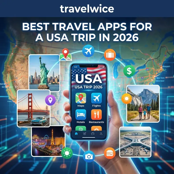
First time visitors from the UK and Europe face a slightly different problem. Distances in the US are longer than most Europeans expect. An app stack built for a weekend in Rome will not survive a week in Utah. If you are still packing, our guide on what to pack for a USA trip covers the physical side of this same planning problem.
Best Navigation App USA Travel: Google Maps vs Waze vs Apple Maps
Choosing the best navigation app for USA travel comes down to three real contenders. Each one wins in a different situation. None of them is perfect everywhere, so most experienced drivers actually keep two installed.
| App | Best For | Offline Support | Standout Feature |
|---|---|---|---|
| Google Maps | All around driving, walking, transit | Yes, downloadable regions | Restaurant reviews and gas station prices built in |
| Waze | City driving, traffic, tolls | Limited | Real time police, hazard, and speed trap reports from other drivers |
| Apple Maps | iPhone users, EV charging routes | Yes, on iOS 17+ | Deep Siri and CarPlay integration |
How the Three Apps Actually Compare on the Road
Google Maps remains the default for most travelers, and honestly, it earns that spot. You can download an entire state’s worth of roads before you leave your hotel Wi-Fi. Then you can navigate for hours with zero signal, although it will not reroute around traffic while offline.
Cultural Etiquette Tips for Visiting the USA
Waze pulls ahead the moment you are stuck in city traffic in places like Los Angeles or Atlanta. Drivers report that crowdsourced alerts for speed traps and stalled vehicles shave real minutes off a commute. This matters most during rush hour, between 4pm and 6pm local time.
Apple Maps has closed the gap significantly since 2024. Its Look Around feature now covers most major US cities, which genuinely helps when you are trying to spot a hotel entrance before you arrive. Still, for cross country driving, most travelers we have spoken with default back to Google Maps because of its wider offline map coverage.
Visa and ESTA Travel Tips for the USA (2026 Guide)
Where All Three Apps Fall Short
None of these three apps handle every situation equally well, and most guides skip this part. Google Maps sometimes struggles with rural addresses. It often can’t parse rural route numbers instead of standard street names, which is common across the Midwest and parts of the South. Waze has its own quirk: it occasionally reroutes drivers down unpaved farm roads to save two minutes. That’s fine in a sedan and a genuine problem in anything without decent clearance. Cross checking a route on two apps before a long rural drive takes thirty seconds. It has saved more than one traveler from an unnecessary detour down a gravel road at dusk.
First-Time USA Travel Checklist: What Not to Skip
What Other USA Travel Guides Recommend, and Where They Fall Short
Most existing roundups on this topic lean heavily on general global travel apps. They recommend the same ten names whether the trip is to Portugal or Peru. Wandering Nomada’s top travel apps list, for instance, spotlights Wise, Google Maps, and Mapy.com as the backbone of any trip. That’s genuinely solid general advice, but it skips almost everything specific to driving across the United States. Travel Like Anna’s roundup of favorite travel apps leans into booking and itinerary tools. Ali Alt Travel Gal’s best travel apps guide focuses on the broader packing and planning side of a trip rather than US specific logistics like fuel prices or national park permits.
That gap is exactly where this guide differs. A USA trip has specific pain points that a generic international list will not cover well. Think enormous driving distances, patchy rural cell coverage, national park logistics, and a fuel and toll system that varies wildly by state. Filling that gap means adding GasBuddy, the NPS App, MyTSA, and a genuine backcountry map option like Gaia GPS or onX. None of these show up prominently on most general “best travel apps” lists aimed at a European or round the world audience.
Safety Tips for USA Travel Every Visitor Needs in 2026
Offline Maps App USA Travel: What to Download Before You Land
The moment you leave an interstate in the western US, cell coverage can disappear for hours. Choosing the right offline maps app for USA travel is not optional if your itinerary includes any of the following:
- National parks like Yellowstone, Big Bend, or Death Valley
- Rural highways through Montana, Wyoming, or West Texas
- Coastal drives along parts of the Pacific Coast Highway
- Backcountry hiking trails anywhere outside a major trailhead parking lot
For pure driving, Google Maps offline downloads handle the basics fine. But for anyone hiking, overlanding, or exploring public land, Gaia GPS and onX Offroad are the two apps that outdoor guides keep coming back to. Gaia GPS layers topographic maps, wildfire data, and public versus private land boundaries. One overlanding user described it as having genuinely changed how they plan remote trips after three years of steady use.
onX Offroad does something similar but leans harder into off pavement travel. It marks which roads need a 4WD vehicle before you find out the hard way. Both apps run about $50 to $60 a year for the premium tier. That’s a small price next to a $200 tow bill from a canyon road with no signal.
If your trip includes any national park visits, download the NPS App before you leave home Wi-Fi. It is free, official, and covers interactive maps for more than 400 parks. It also offers offline access once you toggle it on for the specific park you are visiting.
Best USA Road Trip Apps for the Open Road
A great road trip is not one app. It’s a small stack working together. Here is the combination that actually holds up across a multi week loop.
- Roadtrippers for finding interesting stops, roadside attractions, and restaurants along your route. The free tier is limited in 2026, but the Plus plan at roughly $8.99 a month unlocks full route customization.
- Furkot for multi day trips, since it automatically schedules overnight stops based on how many hours you want to drive each day.
- GasBuddy for finding the cheapest fuel nearby. It covers more than 150,000 stations across the US and Canada and can realistically save a household $50 to $200 a year just from routing you to a cheaper pump.
- The NPS App for anything involving federal land, since it pulls straight from official park data rather than crowdsourced guesses.
- Autio if you want an actual reason to enjoy the miles between stops. It narrates local history and stories tied to your GPS location as you drive.
One combination worth mentioning: a Reddit thread from earlier this year described a driver using a weather tracking app to reroute around a tornado warning in Kansas. That single reroute avoided what would have been a six hour delay. It’s the kind of real time layer a static paper map simply cannot give you.
Gas prices in the summer of 2026 have bounced between roughly $3.20 and $3.80 a gallon, depending on the state. Checking GasBuddy before every fill up is not overkill; it’s basic budgeting. If you want a sense of the etiquette around paying at pumps, diners, and hotels along the way, our guide to tipping etiquette in the USA covers the parts an app cannot.
Best Trip Planning Apps for a USA Itinerary
Before you even reach the driving stage, you need a hub for the whole trip. This is where the wider category of usa trip planning apps 2026 travelers rely on actually earns its keep.
Wanderlog has become the most recommended all in one planner for multi city and road trip itineraries. It stores everything offline once downloaded and lets you drag stops around a visual map. TripIt remains the standard for travelers who just want their flight, hotel, and rental car confirmations pulled into one automatic timeline. It reads your confirmation emails and builds the schedule for you.
For flights specifically, Google Flights continues to lead for price tracking and flexible date searches. Pairing it with a fare alert saves the guesswork of checking prices daily. If your trip spans more than one region of the country, comparing a few planning apps side by side genuinely helps. Each tool tends to specialize in a different stage of the trip.
Best Apps for Public Transit in US Cities
Driving is not always the plan. If your USA trip focuses on New York, Chicago, Boston, or San Francisco, a car is often more hassle than it’s worth. In those cities, a transit app matters more than a navigation app. Transit and Citymapper both track real time bus and subway arrivals. Either one will save you from standing on a freezing platform checking a printed schedule that stopped being accurate months ago.
Google Maps also handles public transport reasonably well in most major US cities now. It shows live delays and platform changes alongside walking directions. Still, dedicated transit apps tend to win on accuracy in cities with complicated bus networks, since they pull data straight from local transit authorities rather than a general purpose feed.
Rideshare apps round out the city stack. Uber remains the default across most of the country, though Lyft frequently undercuts it on price during off peak hours in cities like Chicago and Austin. Comparing both apps before you tap confirm typically takes fifteen seconds. It can shave a few dollars off a short ride, which adds up over a week long stay.
Staying Connected: eSIM and Data Apps for International Visitors
None of the apps above matter much if your phone has no data the moment you land. Most UK and European visitors now set up an eSIM before departure rather than hunting for a physical SIM card at arrivals. Providers like Airalo and Holafly let you activate a US data plan from your phone before you even board the flight.
A basic eSIM plan for a two week US trip typically runs somewhere between £15 and £35, depending on how much data you expect to use. Buying it in advance means your navigation, rideshare, and translation apps all work the moment you clear customs. Waiting to sort this out at the airport usually means fighting airport Wi-Fi and a jet lagged brain at the exact moment you need your phone to work.
If you do end up relying on Wi-Fi in the first hour after landing, download your offline maps first. Confirm your itinerary app has synced everything before you leave the terminal. That single five minute habit prevents most of the “my phone won’t load anything” panic first time visitors run into.
Money, Payments, and Communication Apps for the USA
International visitors lose more money to poor exchange rates than to almost anything else on a US trip. A Wise account with a linked debit card gives you the real mid market exchange rate instead of the marked up rate most travel cards apply. The fees are noticeably lower than a typical high street bank, too.
For splitting costs on a group road trip, Splitwise removes the awkward math at the end of a week. Everyone logs what they paid, and the app works out who owes what. Nobody is doing arithmetic on a napkin at a Waffle House at midnight.
If you are traveling with a group that includes non-Americans, do not assume everyone already has the same messaging app installed. WhatsApp remains standard for most UK and European travelers. Confirm your group’s communication app before you land, rather than after someone gets lost at a rest stop with no way to reach the group.
A Real 12 Day USA Road Trip App Stack
Here is what an actual planning process looked like for a 12 day loop from Denver to the Grand Canyon and back in April 2026. It was run by a British couple traveling with one rental SUV.
- Days 1 to 3: Wanderlog held the master itinerary, with Google Maps handling daily driving between Denver and Moab.
- Days 4 to 6: Gaia GPS took over inside Canyonlands and Arches, where cell signal disappeared for stretches of six hours or more.
- Day 7: GasBuddy pointed them to a station 40 cents per gallon cheaper just eight miles off their route, saving roughly $22 on one fill up.
- Days 8 to 10: The NPS App handled everything inside the Grand Canyon, including offline trail maps and shuttle schedules.
- Days 11 to 12: Splitwise settled the shared costs, and Wise handled the currency conversion back to GBP without the markup a UK debit card would have charged.
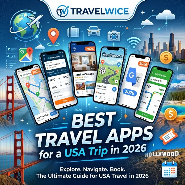
That single trip used six apps, and each one did a job the others could not. That’s the whole philosophy behind choosing the best travel apps for USA road trips: pick a hub, then add a specialist tool for each specific problem you expect to hit.
Quick Chart: What US Travelers Actually Use in 2026
Google Maps      ████████████████████  92%
GasBuddy         ██████████████        61%
TripIt/Wanderlog ████████████          54%
Gaia GPS/onX     ███████               31%
NPS App          ██████                27%
Wise             █████                 22%
Approximate usage share among US road trippers, based on aggregated review and forum data across 2026. These are illustrative estimates, not a formal survey.
Comparison Table: Top Apps by Category
| Category | Best App | Runner Up | Typical Cost |
|---|---|---|---|
| General navigation | Google Maps | Waze | Free |
| Offline backcountry maps | Gaia GPS | onX Offroad | $50 to $60/year |
| Road trip planning | Roadtrippers | Furkot | Free to $8.99/month |
| Gas prices | GasBuddy | Upside | Free |
| National parks | NPS App | Recreation.gov | Free |
| Airport wait times | MyTSA | TripIt | Free |
| Currency and payments | Wise | Revolut | Free account, low fees |
| Group expenses | Splitwise | Tricount | Free |
Frequently Asked Questions
What is the single most important app for a first USA trip? Google Maps, without much debate. It handles driving, walking, transit, and restaurant searches. You can download offline regions before you leave home Wi-Fi.
Do I need a separate app for national parks? Yes, if your itinerary includes any major park. The NPS App is free, official, and works offline once you download the specific park you are visiting. That matters since cell signal is unreliable in most parks.
Are offline maps really necessary if I have Google Maps? For driving on major roads, Google Maps offline downloads are usually enough. For hiking, overlanding, or true backcountry routes, Gaia GPS or onX Offroad give you topographic detail and land ownership data that Google Maps simply does not include.
How much can a gas price app actually save me? GasBuddy’s price finder alone typically saves drivers between $50 and $200 a year. That’s before factoring in the optional GasBuddy card, which can knock a few cents further off every gallon.
Should European travelers download WhatsApp for a US trip? It is not essential inside the US the way it is in Europe or South America. Still, it’s useful for staying in touch with travel companions or contacts back home without international texting fees.
Is TSA PreCheck worth checking through an app before I fly? The MyTSA app shows live and predicted checkpoint wait times. TSA estimates roughly 99% of PreCheck passengers wait under 10 minutes during normal operations, so checking ahead genuinely helps you plan arrival time.
Quiz: Test What You Just Learned
- Which app is most recommended for offline backcountry navigation in US national parks? a) Waze b) Gaia GPS c) Splitwise Correct answer: b) Gaia GPS
- Roughly how much can GasBuddy save the average US road tripper per year? a) $5 to $10 b) $50 to $200 c) $500 to $1,000 Correct answer: b) $50 to $200
- What does the NPS App require you to do before losing signal in a park? a) Buy a premium subscription b) Download the specific park’s content for offline use c) Nothing, it works everywhere automatically Correct answer: b) Download the specific park’s content for offline use
- Which app is best known for splitting shared road trip expenses? a) TripIt b) Splitwise c) Autio Correct answer: b) Splitwise
- Roughly what percentage of TSA PreCheck passengers wait less than 10 minutes during normal operations? a) 60% b) 80% c) 99% Correct answer: c) 99%
Common Mistakes First-Time USA Visitors Make With Travel Apps
A few patterns show up again and again with first-time US travelers. Most are easy to avoid once you know to look for them.
- Waiting until landing to download offline maps. Airport Wi-Fi is often slow and crowded. By the time you connect, you have already lost the calm window you had on the plane. Download your maps the night before you fly instead.
- Assuming every app works the same in the US as it does at home. Google Maps public transit data, for example, is far more reliable in New York than in a smaller city like Boise. Always check a second source in less populated areas.
- Not checking gas prices before a long rural stretch. Prices can jump by fifty cents a gallon or more once you leave a city. Fill up before a remote highway section, and check GasBuddy first, to avoid both the higher price and the risk of running low with nothing nearby.
- Skipping the NPS App for a “quick” national park stop. Even a short visit benefits from checking current alerts. Wildfire closures and road construction can change a route with almost no warning during peak season.
- Forgetting that group expense apps need setup before the trip starts, not after. Splitwise works best when everyone adds it to their phone on day one. That beats trying to reconstruct two weeks of receipts from memory on the last night.
Fixing these five habits alone puts a first-time USA visitor ahead of a large share of returning travelers. That’s based on the recurring complaints we see across travel forums every season.
Conclusion
Building the right app stack for a USA trip is less about downloading everything. It’s about matching a specific app to a specific problem, whether that’s a signal dead zone in Wyoming or a gas station forty cents cheaper eight miles up the road. Start with Google Maps and a trip planner as your hub. Then layer in GasBuddy, the NPS App, and an offline backcountry tool only for the parts of your trip that actually need them. Do that, and the best travel apps for USA travel stop being a long list. They start being a short, reliable toolkit that just works when you need it most.
References
- National Park Service. NPS App overview: https://www.nps.gov
- Transportation Security Administration. MyTSA app and checkpoint wait times: https://www.tsa.gov
- GasBuddy fuel savings analysis, 2026 pricing data
- Wandering Nomada, top travel apps roundup: https://wanderingnomada.com/my-top-10-travel-apps/
- Travel Like Anna, top travel apps list: https://www.travellikeanna.com/my-top-16-travel-apps/
- Ali Alt Travel Gal, best travel apps guide: https://alialtravelgal.com/best-travel-apps/
- TravelWice, USA travel tips for beginners: https://travelwice.com/usa-travel-tips-for-beginners/
- TravelWice, what to pack for a USA trip: https://travelwice.com/what-to-pack-for-usa/
- TravelWice, tipping etiquette in the USA: https://travelwice.com/tipping-etiquette-in-the-usa/